Monday, March 26, 2018

Liveblogging the Deluge: 2018 Short Version

High water on the Tuolumne River, February 2018, about 15,000 cubic feet per second.

Why "short"? What deluge? Hasn't this been another dry year?
Tuolumne River on January 19, 2018, flow at about 300 cubic feet per second.

If you've been reading over the last year, you would know that I started what I thought would be a short blog series (Liveblogging the Deluge) on what looked like (and almost was) a record-breaking atmospheric storm that hit California last January. The storm hit, and then there was another. And another. Prodigious amounts of snow and rain fell in central and northern California through the end of April, putting an end to California's historically bad five-year drought, and filling the state's dry reservoirs. So much snow accumulated in the drainage of the Tuolumne River that the main reservoir, Don Pedro, was constantly at the edge of overflowing, so the outflow was maintained at near flood-level (averaging 9,000 cubic feet per second, briefly to 15,000 cfs) through July. We really had no chance to see the changes on the floodplain until September.
Tuolumne River on March 25, 2018, flow at about 4,500 cubic feet per second

And then...when the "storm door" was supposed to open in November, barely anything happened. My backyard gauge told the story: October, 0.07", November 1.15", December 0.0". January finally brought an almost normal amount, 3.44", but the next month was one of the driest Februarys ever recorded, with my gauge recording a mere 0.37". Statewide, the snowpack was a mere 20-25% of normal. At Don Pedro Reservoir, there was a lot of water in storage, but realizing that there would be almost no snowmelt, the operators kept the outflow into the lower Tuolumne River at very low levels, about 300 cubic feet per second. They left a minimum of space for emergency flood control.
Tuolumne River, January 19, 2018, flow at 300 cubic feet per second.

And then March happened. The storm door opened in a big way, and three major storms blew through the state raising havoc with floods and mudflows in numerous localities, including some of the areas affected by the horrific fires of last summer (and December, unfortunately). Locally, we received 3.36", but my little town was one of the driest spots in the state. The snow in the Sierra Nevada was measured in feet, including 7-8 feet in a few places.
Tuolumne River on March 25, flow at 4,500 cubic feet per second.

It wasn't a drought ending month, but it took the snowpack from disastrous to merely disappointing. Current levels range from 44% to 66% of normal. And now the operators at Don Pedro Reservoir can expect some runoff amounts that will be semi-normal. That means they'll need a bit more reservoir space....

I noticed the first ramping up of river flows about a week ago, when the discharge was tripled to about 1,000 cubic feet per second. I could hear the river again (the velocity of the water at 300 cfs is very low). But then when I walked the river trail yesterday, the river was raging along at 4,500 cubic feet per second. Not a flood, but a higher level than at almost any point during the entire run of the 2012-2017 drought. The islands and gravel bars that were being used by fisher-people and picnickers were once again underwater. The slough at the west end of the Parkway Trail where I walk was once again flowing. This is good on a number of counts: salmon and other fish will have a better chance of survival and getting to the sea, and the invasive weed river hyacinth will probably not gain root in the upper areas of the river. The river weed choked the slough and parts of the river channel during the drought, smothering out other vegetation, and making life difficult for fish and aquatic wildlife.

Farther afield, the outlook is reasonably good. Most of California's reservoirs are at or well-above normal (flood-damaged Lake Oroville is an exception at 75% of normal). Don Pedro came up at least 8 feet during the storms in March.
While good for the snowpack and reservoirs, the storms did a lot of damage. Roads were washed out in numerous places in the foothills of the Sierra Nevada. We almost lost a smaller reservoir on Moccasin Creek. In the end, the "Deluge" was a lot shorter than the one we got last year, but in a year as dry as this, it was good to have a little extra water "in the bank". With the uncertainties related to global warming, and the expectation of future extended droughts, every drop counts.

Thursday, March 22, 2018

The Rise of the Turtles and a Flat Earth: Musings on Science and Death Valley

One of the ominous turtles rising from the crust in Death Valley
I've been dismayed to say the least at how gullible Americans have become, in so many ways. We could of course get mired in a discussion of politics, or charlatans in religion, but my real concern on this particular day is over the resurgence of flat-eartherism in current pop-culture. A couple of singers and basketball players made waves recently by looking towards the horizon, and deciding all on their own that the Earth must be flat because that's how it looks. All of that "stuff" about NASA and satellites and moon missions are, in their view, hoaxes.
Draw closer if you dare...

I imagine there are many reasons for this, but a large part of the problem has to do with a pushback against "authority" in society these days, with an increasing lack of trust in government and social institutions like the traditional media and religion. In a number of cases, the mistrust has been earned, but unfortunately science and scientific knowledge have ended up being lumped with the other "authorities" even though the concept of authority in science is different from the others. The authority of science is based on observation and research and has a systematic way to weed out false "facts" from objective truth (it's not perfect, of course, but the structure tends to be self-correcting over time).

Unfortunately, with the decline of science education at many levels of public and private education, the distinction has been lost in some quarters. As a result, science becomes another of the buffet of human ideas that can be believed or not believed as one wishes. The consequences will be (and indeed already are) tragic. We have a government, the only one in the world, that doesn't "believe" in climate change. It doesn't think health will suffer if we allow untested or poorly tested toxins into the environment, or if we allow increased air and water pollution. Science is taking a back seat to profit, and people will suffer and die for it. If the voting population is ignorant of the issues, and ignorant of how science works, the abuses will continue unabated.

This has led to an interesting exercise I like to do with my students. We introduce how the scientific method works (make observations, collect data, devise hypotheses, test the hypotheses, and if fully supported, designate a theory). Then we do a mind game where we place ourselves in our home here in California's Central Valley a few thousand years ago, with the knowledge and technology of the time. What would the shape of the Earth be from that point of view? There are different layers in the answers to such questions.

The first-order answer is "of course the Earth is flat". One merely needs to look around the exceedingly flat Central Valley to see that this is true. It is an explanation that works for everyone concerned and has no serious impact on their daily lives.

But there is a second-order observation to be made. A curious person might climb a local mountain and note that with the wider view that the mountain ranges in the far distance seem to disappear over the horizon (or they might see that ships disappear over the horizon at sea). The realization emerges that the world isn't as it seemed. It is dome-shaped! This new truth has implications. A flat earth offers no reasons for disasters such as earthquakes and floods such as those experienced by the inhabitants on the valley floor.

So a model is proposed to explain the observations (dome-shape, earthquakes, floods): it is suggested that the earth is actually...on the back of a gigantic turtle. When the dust clears, the analyses and arguments can begin. Turtles that we observe don't move very often, and the larger the turtle, the less often they seem to be active. A turtle the size of the earth might not move for months or years, explaining the lack of daily earthquakes. On the other hand, sometimes turtles can be seen submerging themselves in water, providing a handy explanation for occasional floods in our valley.

It might seem mildly outlandish, but the hypothesis is actually valid. If the earth actually was on the back of a turtle, the observed behavior of the planet would have a reasonable explanation.

I usually get a few giggles and chortles, but then I ask the class to prove that the earth is not on the back of a turtle. And things go a lot quieter. A few people will point out that there are pictures of the earth from space, but I respond with the fact that I've seen pictures of Tatooine (Star Wars), or Planetoid LV-426 (Alien) that were very convincing. And then they are at a loss. They haven't had the scientific background that gives them the skills to challenge oddball claims and frauds.

One night many years ago I had one of these great teaching moments. After our discussion, I had the class follow me outdoors, and we looked into the sky at the moon, which I knew was undergoing a lunar eclipse at that very moment. We could look into the sky, and see that the Earth was casting a circular shadow across the surface of the moon. No turtle legs or tails or heads anywhere.
Lunar eclipse of January 2018. No legs, no heads are apparent.

From there we can advance to a discussion of how Eratotosthenes calculated the size of the spherical earth 2,000 years ago, and how modern satellites can detect the flattening of the polar regions of the earth, making it more accurate, and defining the globe as an oblate spheroid. When we take into account the ocean basins and mountain ranges that deviate from a perfect spheroid, we arrive at last as the current description of the Earth: a geoid, an "earth-shaped" object.

In the end, the point of the exercise is not about the shape of the Earth, but about how science works: our observations and conclusions may change in time, but because of new information and evidence, each of our models is more accurate, and closer to the actual truth. We can even acknowledge that we still don't completely understand the geometry of the Earth, realizing that there might be additional dimensions of which we are not yet aware.

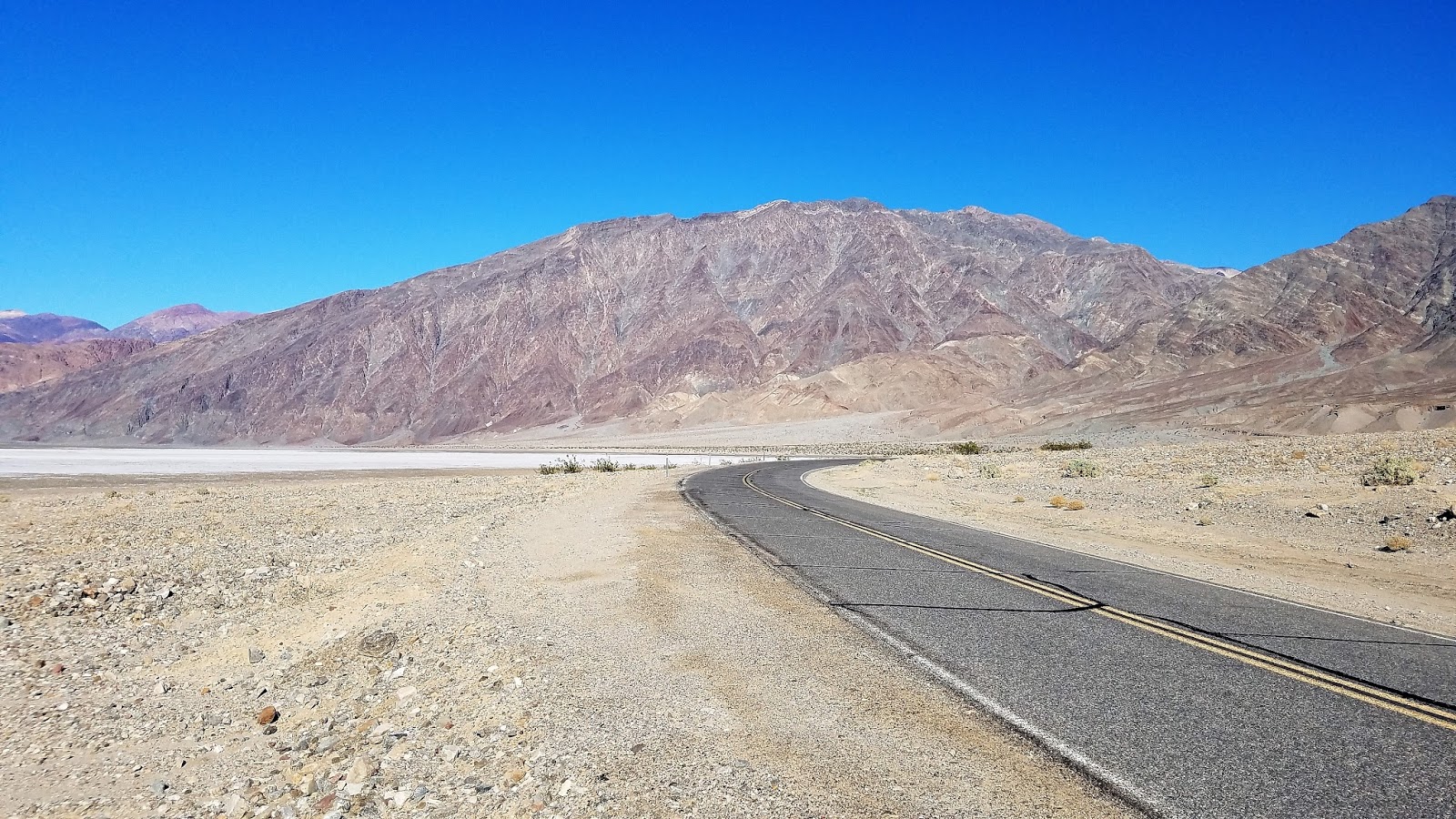
So what does that have to do with all of these pictures from Death Valley? I was very seriously going to try and make a pathetic joke that the Earth actually is made of turtle shells. A look at the top two pictures reveals the presence of some dome-like structures nearly unique to Death Valley that are actually called turtlebacks. So it is clear that the Earth is not on just one turtle. It is on top of a great many turtles, and as a result of crustal stretching and thinning, some of the turtles are breaking through the crust and entering into the upper world like marauding monsters. And there is a government conspiracy to keep these facts hidden from us...
You can access an exposure of the Badwater turtleback fault in Natural Bridge canyon. The hike is just a half mile or so.
But no, I'm not going to go there.

When these enigmatic structures were first studied in detail, they were thought to be like domes found elsewhere in the world, formed largely by compressional forces. That description, like the first order observation about the shape of the Earth sort of satisfied researchers as they worked on other regional problems, but further observations showed features inconsistent with compressional deformation. Most of the surfaces on the turtlebacks were sheared fault planes, not folded strata, and the other faults nearby were extensional ("normal") faults. As a general rule one doesn't expect to find contemporaneous faults showing oppositely oriented stresses.

Questions were raised and researchers began to doubt their original assumptions, and a new model of turtleback formation was proposed that involved extensional forces. The low-angle normal faults associated with the turtlebacks were soon being called detachment faults, and the dome-like systems of ancient metamorphic rocks were termed metamorphic core complexes. These were a new kind of fault, previously unrecognized and undescribed. Their recognition opened up new avenues of research, and new mysteries. A complete analysis is far more than can be accomplished in a blog piece like this, but I can direct you to a nice synthesis of current research on turtlebacks at this link.
The fault surface runs diagonally across the upper part of the photo.
Unlike politics or religion, where belief and opinion are the driving forces, science thrives on observation, analysis, and shared effort towards discerning the best possible explanations for a given phenomenon. One doesn't "believe" in science, and one can never assume that a given answer is the ultimate truth. This can be a difficult concept for many people, and is one of the main reasons that the educational system needs to maintain science programs as a high priority.
The fault runs roughly across the middle of the picture. This is in Natural Bridge Canyon.
On the other hand, maybe the flat-earthers are right, and the Apollo lunar missions never happened, and the edge of the world is a 150 foot high wall of ice guarded by NASA henchmen. And there are zombie dragons on the other side preparing to invade our planet...winter is coming. If you wish to believe it, it must be so.

Monday, March 19, 2018

Mrs. Geotripper Faces Down the Wolf: Musings on the Canids of the Great Valley

Note: I know this is a coyote, not a wolf. But read on to see why I used the term
They've always been here.

They've always been here, even though we declared war on them, and have tried to exterminate them out of existence. No doubt they're been preying on our chickens, our sheep, our calves, or whatever, but they were here first and we were the interlopers, the invasive species. We came and plowed under the prairies and river floodplains that were the ancestral homes of these creatures.
Photo by Mrs. Geotripper
They've been here ever since the prairie rose from the sea sometime in the last 10 million years. At that time, volcanoes still erupted at the crest of the Sierra Nevada, sending lava flows and volcanic mudflows (lahars) down the western slope. The rock layers today are called the Mehrten Formation, and those rocks are the focus of a study published this week by among others, my colleague at CSU Stanislaus Julia Sankey, and a former student of mine, Jake Biewer. They were looking at the fossil canids reported from the Mehrten, and their work shows that the ecosystem at that time included at least four dog ancestors. There were two borophages (a primitive "bone-crushing dog" that is now extinct), an ancestral fox, and Eucyon davisi, a canid that is considered to be an ancestor of today's coyote.

During the ice ages, the ecosystem was dominated by Dire Wolves and Sabertooth Cats, but fossil discoveries show that the coyote was present as well 700,000 years ago. The big wolves and sabertooths could attack and take down the large grazing animals of the time, the camels, horses, and bison, but there was always a place in ecosystem for the smaller predators that could live on rabbits, rodents, and large birds.

At the end of the last ice age (or with the arrival of humans; there is a debate), the megafauna, the large grazing animals like the bison, the mammoth, the camel, the horse, and the sloth went extinct. Deprived of their prey, the large cats and Dire Wolves also disappeared into oblivion. But there was always a place for the coyote, and they prospered in the newly changed world. As humans moved into their environment, they adapted, and have continued to survive despite the war against them waged by ranchers.

So this thing happened today. Mrs. Geotripper and I were doing something we love, exploring the local wildlife refuge (the San Luis National Wildlife Refuge Waterfowl Auto-tour). We were looking for birds as we usually do, but I had just seen the article about the canids, and so I was also watching the prairie for coyotes (or foxes, I wasn't being choosy). And we saw one! It was wandering the grassland, and stayed close enough that we got pictures and video (below). We drove on. Towards the end of the auto-tour there is a hiking trail to a viewing platform. We got out and walked the trail.

Mrs. Geotripper and I have opposing methods of seeking birds. I like to cover as much ground as possible, constantly moving, while she prefers to remain stationary, letting the birds come to her. Both strategies work for us, and we usually get a different set of bird discoveries. So it was that she was situated on a folding chair at a bend in the trail, and I was a quarter mile away at the viewing platform. We were sort of nonplussed at a sign at the trailhead warning of Mountain Lion sightings, but we had phones so we could stay in touch.

I was up on the platform and was startled, yet pleased to see a coyote go loping by at a fast pace. I'm not even sure it saw me, because it never looked my direction. I snapped some pictures, including the ones above and below, as well as the opening picture at the top of the post. I paused and realized the animal was headed down the road towards Mrs. Geotripper's viewing spot, so I figured I would text her a warning. It read (and I quote): "Coyote might be running your way".

She didn't get the text.

The coyote was faster than my fingers and the mysterious ether of the internet, and so from Mrs. Geotripper's point of view things were a little different. She was photographing a Spotted Towhee, (and thinking just a little bit about mountain lions), when she heard something running through the underbrush. She thought "rabbit", but realized it was bigger. Much bigger. And it was coming closer and closer, and she couldn't see it.

Meanwhile, the coyote was taking a shortcut, probably one that it always took, and wasn't really on the hunt, so it wasn't trying to be stealthy. It was just in a hurry to get to wherever it was going, and it ran into the clearing that it always ran into. And found a large creature in the way.

Both of them were too shocked to react for several seconds, but to Mrs. Geotripper's credit, she didn't scream or panic. She just stared, uncertain what the heck to do next. Luckily, the coyote blinked first and ran down the road as fast as it could go. And then Mrs. Geotripper heard her phone ping with the message I had just sent.

She and I had just encountered a bit of the ancient world that existed long before we did. The wolves and coyotes (and domestic dogs) are closely related creatures, and are even capable of interbreeding. That gives them an incredible advantage in a changing environment, whether rapid climate change like the ending of an ice age, or the invasion of their lands by a new species that is as intelligent and crafty as they are. They can adapt quickly, and that's how they have survived for millions of years against many challenges.

Reference: Balisi, M., X. Wang, J. Sankey, J. Biewer, and D. Garber. 2018. Fossil canids from the Mehrten Formation, Late Cenozoic of Northern California. Journal of Vertebrate Paleontology. DOI: 10.1080/02724634.2017.1405009.

Friday, March 16, 2018

All My Faults are Normal, But Not Really: Travels in Death Valley


Death Valley is the ultimate expression of the extensional forces that have ripped apart the crust of the western United States. The affected area reaches from northern Nevada and Oregon, east to central Utah, and south into Arizona. The broken up crust has resulted in the formation of countless fault basins and high mountain ranges (the entire region is called the Basin and Range Province). But few of those basins (really just one, the Owens Valley) approach the grandeur of Death Valley.


The valley (which is just part of the larger national park) is more than a hundred miles long, and it's deep. The vertical distance from the summit of Telescope Peak to the valley floor at Badwater is more than two miles (11,331 feet). Few places in America display greater relief. And the valley was not carved by water or any other erosional force: it is the result of faulting, the movement of the crust of the earth.

Most students of geology are taught early on that fault valleys are called grabens, and that they are formed by normal faulting. That begs the question of "what is normal?" (a concept I'm sure we all struggle with). Faults displaying vertical motion often have a sloping fault plane, and the fault block that "hangs" over the other is called the headwall (which therefore covers the footwall). When the crust is stretched, or extended, the headwall drops relative to the footwall, and that is what defines a "normal fault". If the crust is compressed, the headwall will move up relative to the footwall, forming an "abnormal fault"...no wait, that's my bad joke from the classroom. It's called a "reverse fault".
Death Valley is in an isolated lonely region, except for the main tourist area, which lies mostly along Highway 190 and Badwater Road which leads to...Badwater. But Badwater Road doesn't end there. It continues on to the south end of Death Valley and eventually over Jubilee Pass to the village of Shoshone. Few tourists ever venture this way. But there are things to see out there in the deep desert.
There is an odd little hill on the floor of Death Valley at the south end near the Ashford Mill (the remains of an old mine). It's a cinder cone, a small eroded pile of volcanic cinders and bombs that erupted tens of thousands of years ago. It's out on the valley floor in the midst of the alluvial fans, made up of the gravel and sands eroded from the surrounding mountains. The short climb from West Side Road provides a fine view of the graben of Death Valley. It's odd because it may be the only mountain you will ever climb whose summit is below sea level (-73 feet to be exact).
There are other reasons it is odd. Being in the middle of the valley, there seems no obvious way for lava to reach the surface of the valley. For another, it's in pieces. One half can be seen in the photo mosaic below.
From the main highway (below) it becomes apparent that the two pieces are offset from each other. It's been torn apart by faulting, but not by the kinds of faults we looked at above. The side are moving laterally. This kind with the lateral motion is caused by shearing and is called a strike-slip fault. The presence of the fault provides an explanation for the presence of the cinder cone (the magma was able to follow the fault fracture to the surface). But what are strike-slip faults doing in the Death Valley graben?

There are two kinds of strike-slip faults, right and left lateral. The type can be determined by looking at what the opposite block has done from the observers position: notice below that Pokey moved to Gumby's right. But from Pokey's point of view, Gumby has moved to Pokey's right. That's a right lateral fault.

One can therefore see that Cinder Hill in the Google Earth image below is offset in a right lateral manner, with the southwest portion moving northwest. That's a coincidence (not really) because the San Andreas fault, many miles away to the west, is also a strike-slip fault, and it is moving in the same direction. The two faults are roughly parallel. And that provides a clue about the nature of the faults in the Death Valley region.

There are other strike-slip faults in Death Valley, and they "step over" in such a way that a gap opens between the ends of the fault. In that area the crust is being stretched apart, forming a "pull-apart basin" (below). Death Valley National Park is being stretched apart to form grabens, but the overall motion is towards the northwest as the Sierra Nevada pulls away from the rest of the Basin and Range Province.
The clues to the broad forces affecting the crust of the planet show up in the way that they deform and fracture the rocks at the surface. Observations of an obscure little cinder cone at the south end of Death Valley reveals that the park is part of a much bigger process of continental motions that divide the North American plate from the Pacific plate. The faults might seem normal, but not all of them actually are.


Sunday, March 11, 2018

Waves on Fire at the Devil's Slide near Half Moon Bay

Even though Geotripper is a geology-based blog, it seems ocean waves don't make an appearance all that often in my posts. Try as I might, I don't photograph them very well, or very creatively. I love them, however, and can watch them for hours at times.
I think part of my difficulty is the point of view. Most of the time we are standing on a shoreline and the waves crash in front of us, always with the curl of the impending breaker, and the swash upon the sand beach. Always the same angle. And that's what caught my attention tonight. We had occasion to be in Half Moon Bay at sunset, and it was a truly beautiful splash of color in the sky. We had finished dinner at Miramar, where the coast is a long curving stretch of sand. Certainly pretty, but we wondered what the sunset would look like from a bit higher...like hundreds of feet higher. So, as the sun sank closer to the horizon, we headed north on Highway 1, and soon reached the new tunnels at Devil's Slide.
The Pacific Coast Highway was meant to hug the coast from Mexico to Oregon, and the effort to complete it was monumental. Regrettably, almost all of California's coastal cliffs bear the scars of road construction, and only about 25 miles of the state's spectacular shoreline remains as true wilderness. Just the same, there is no experience quite like following this highway from one end of the state to the other. It begins in the nightmare of urban traffic throughout most of Southern California, leading to winding mountain roads through immense Redwood forests in the north. Of all the spectacular stretches of highway, the one between Half Moon Bay and Pacifica has given road engineers the biggest headache of all. It's called the Devil's Slide.
The highway was built over an active landslide hundreds of feet above the shoreline. From the very beginning, the road experienced constant damage from slope failures, and the highway was often closed for expensive repairs. The powers-that-be finally gave up and eventually built the Tom Lantos Tunnels through the mountain behind the slide and closed the old highway in 2014. It was given to the county and is now operated as a trail and scenic overlook.

That's where we found ourselves tonight at sunset: hundreds of feet above the shoreline looking almost straight down on the crashing waves. I realized I was seeing something unique, the waves from above, with the dramatic light of the sun on the backside. It was an indescribable sight, so I won't even try. You'll just have to enjoy the pictures.
I've included a couple of pictures of the broader view so you can have some context for understanding the pictures above.
The waves are rolling into a narrow cove, and break as they reach shallow water. The shore is mostly bedrock with no sand, so as the waves break, they often reflect (bounce off the water's edge) and roll backwards, breaking again against the other side of the cove. The intersecting waves create an interesting tapestry.


Despite the imposing name, the Devil's Slide is one of the most spectacular stretches of the California coast, and is not to be missed if you ever find yourself in San Francisco. It's no more than 30 minutes from downtown or the airport. I've often visited there while waiting to pick up people from the airport.

Saturday, March 10, 2018

How Low Can You Go? Badwater Basin, and a Real Hell on Earth


Salt flats at Badwater, -282 feet. The snowcapped mountain in the distance is Telescope Peak, 11,049 feet.


How bad could it be? On our recent trip to Death Valley, we made the rather mandatory pilgrimage to Badwater, the lowest point in North America at -282 feet (86 meters). Although the hottest temperature ever recorded on planet Earth was measured at Furnace Creek Ranch in 1913 (56.7°C; 134°F), it is known that Badwater is often 2 degrees hotter. That's hot. Really hot.
I've regularly worked and played in temperatures as high as 105°F without ill effect at home in the Great Valley of California. I floated down the Colorado River in August of 2013 where temperatures soared as high as 118°F, and I realized that I could have been in trouble if we didn't have the river to dip in every few minutes (because it flowed from deep within Lake Powell, the water temperature was around 48°F even many miles downstream). The hottest moment I've ever experienced was in the aforementioned Death Valley when we had an occasion to be there in late May, and an early heat wave shot temperatures to a near record 122°F. It was simply intolerable outdoors...we retreated to the motel room until the sun went down before emerging to seek dinner. People no doubt adapt to such conditions, but it can't be pleasant.
Alluvial fan just south of Badwater. The terraces on the fan are fault scarps, indicating the role of faulting in the subsidence  of Death Valley.


Standing at the lowest point in North America does cause one to consider other low places on the planet. The National Park Service provides a handy guide on interpretive signs and on their websites. They note that all of the low places also tend to be exceedingly dry and hot, and that the source of the low elevation is generally tectonic in origin. Those low points are as follows:
Dead Sea (Jordan/Israel) -1360 feet (-414 m)
Lake Assal (Djibouti, Africa) -509 feet (-155 m)
Turpan Pendi (China) -505 feet (-154 m)
Qattara Depression (Egypt) -435 feet (-133 m)
Vpadina Kaundy (Kazakstan) -433 ft (-132 m)
Denakil (Ethiopia) -410 ft (-125 m)
Laguna del Carbón (Argentina) -344 ft (-105 m)
Death Valley (United States) -282 ft (-86 m)
Vpadina Akchanaya (Turkmenistan) -266 ft (-81 m)
Salton Sea (California) -227 ft (-69 m)
Sebkhet Tah (Morroco) -180 ft (-55 m)
Sabkhat Ghuzayyil (Libya) -154 ft (-47 m)
Lago Enriquillo (Dominican Republic) -151 ft (-46 m)
Salinas Chicas (Argentina) -131 ft (-40 m)
Caspian Sea (Central Asia) -92 ft (-28 m)
Lake Eyre (Australia) -49 ft (-15 m)
The Black Mountains provide the backdrop to Badwater. They rise steeply more than a mile above the salt flats.


Looking at this list, it is clear that the Dead Sea is in a class by itself as far as low elevations are concerned. At nearly 1,400 feet below sea level, it is unique in the world. To find anything deeper, we have to reach back into the depths of geologic time. The Strait of Gibraltar is narrow and shallow, and is the only connection between the Mediterranean and any other ocean. What would happen if it ever separated the two oceans? It's not totally idle speculation...it turns out that this actually happened, about six million years ago. The speculation began when vast amounts of salt, gypsum and anhydrite deposits were discovered beneath the seafloor sediments of today's Mediterranean Sea.


When the cutoff occurred, the Mediterranean immediately began to dry up. And dried more. And then even more. The level of the sea dropped precipitously. It dropped past the 1,000 foot level. And then 2,000. And it kept going. Until the level of the basin reached 15,000 feet below sea level. Three miles below sea level. The implications are staggering in many ways. The Nile and Rhone Rivers would have started cutting deep channels far below their normal level. In places, the subsequent sedimentary layers hide canyons that were once 8,000 feet deep (The Grand Canyon, for comparison is 5-6 thousand feet deep). 
The climate changes would be extreme. Air sinking into the basin would increase temperatures at the dry adiabatic rate of 5.5°F per thousand feet. That amounts to conditions at the lowest reaches of the Mediterranean Basin that would be 70°F higher than they would be at sea level. In this desert environment, summertime temperatures could reach 176°F. No organisms could survive at these levels except for a few thermophiles. This is a place no human could or would be able to venture.


And imagine the end. Imagine the moment that the Atlantic Ocean began seeping over the Strait of Gibraltar. Seepage that turned into a torrent, and then a torrent that turned into a flood, and a flood that turned into a deluge beyond imagining. Some calculations suggest flows equivalent to 1,000 Amazon Rivers at once. The entire ocean basin could have filled in between a few months to two years. Sea level would have risen as much as 30 feet per day. This event is called the Zanclean Flood.

All in all, this place would have been hell on Earth, at least until the waters came...

PS: The Rhone River, not the Rhine. Correction made, thank you Olivier Malinur.

Wednesday, March 7, 2018

Yosemite's Half Dome Makes an Appearance...in the Central Valley

Once a week, my errands take me past the intersection of Keyes and Hickman Road on the floor of California's Central Valley. There is usually nothing much to be seen there in the late afternoon hour, just some fields of crops and almond orchards. Nothing much that is, except for the rare clear days in our usually smoggy and dusty valley. On those days, the Sierra Nevada can be seen off in the distance, and from a narrow angle, one can see the looming edifice of Half Dome, rising 4,000 feet above Yosemite Valley. Today was one of those days.
It's been a little controversial, because there are some who think it is not possible to see the dome, and indeed it is not easy to see unless you know just where to look. My pictures are at zooms ranging from 60x to 120x. The picture below provides an idea of the appearance with the naked eye. The dome itself is mostly to the left of center. One has to keep in mind that the rock is something like forty miles away, and there are even effects caused by the curvature of the earth that make it look odd.
The previous day had been clearer, but I just couldn't get away to try for the picture. I had to sharpen the contrast and play with the other settings to bring out the dome. Some are surprised that it doesn't form the skyline, but the peaks behind reach elevations of 12,000 feet or more. Half Dome isn't even 9,000 feet high. I only discovered the view because the first time it was visible to me, there were clouds obscuring the peaks behind, causing the dome to stand out as if it were on the skyline.

We'll see if the storms next week clear out some of the dust and smog...